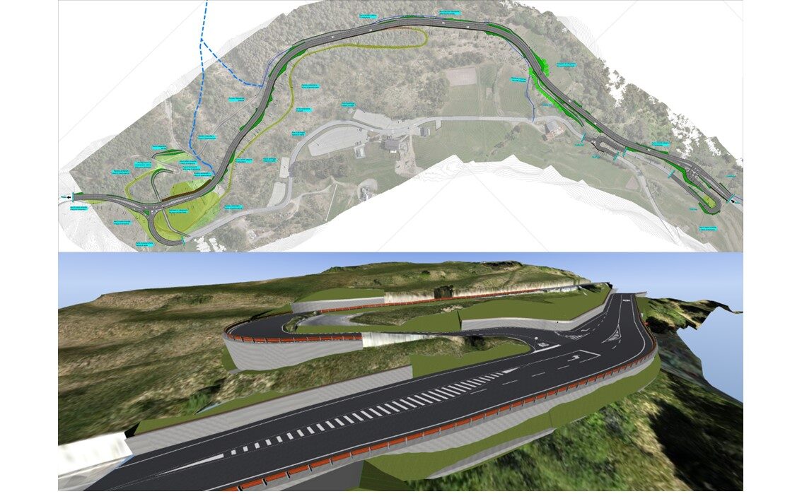
The intervention aims to create an alternative route to reach Livigno, avoiding the crossing of Bormio and the hamlet of Premadio in Valdidentro, a situation that, especially during periods of high tourist influx, has always caused significant traffic congestion. The alternative to the provincial road is about 1200m long, with the road platform being of the “secondary extra-urban road F2” type. The mountainous context in which the work is located has necessarily conditioned the design choices and the need to create significant support structures, either gravity-based or with anchored bulkheads: indeed, the road develops almost entirely on a mid-slope on a very steep side, especially in the southernmost part. Special attention was given to the planimetric and altimetric definition of the route, in order to minimize excavation and earth movements. The design was carried out using BIM methodology, starting from LIDAR survey of the terrain and determination of the terrain’s DTM.

