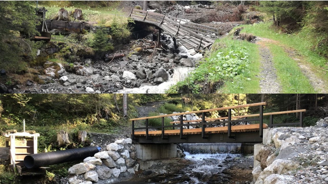
The project pursued the dual objective of restoring the both hydraulic functionality of the D’Ornella stream basin and the municipal-forestry viability, compromised because of the “Vaia” storm: the passage of the flood has in fact resulted in both the collapse of banks of works and slopes, but also of the crossing bridges of the stream. The design therefore provided for the realization of works compatible with exceptional flood events. Alongside those closely connected with the road, there are, therefore, interventions for the accommodation, stabilization and restoration of bedsides and slopes such as to allow the passage of the flows safely and to increase the real safety of the roads and the inhabitants of Col D’Ornella and surroundings. The campaign of surveys and inspections carried out was of fundamental importance. The survey was carried pout by means of aerophotogrammetry, integrated by GPS, to ensure coverage over the entire work area, particularly extended by including an entire landslide slope on which natural engineering works have been designed (weirs and gutters made of timber-stone) to contain the hydro-geological mess and for optimal landscape insertion. Geological and geomorphological surveys have seen the execution of HVSR seismic survey and passive seismic surveys lines, to locate the rocky bedrock below the foundations of the new bridges under design. The estimate of the project flow rates, considering the different closing sections, was determined by applying hydrological modeling through HEC-HMS software. They were then verified, considering a two-hundred-year return, both the hydraulic francs to the new bridges and the bed river works, such as cliffs, thresholds, and bridles.